
First Day of Spring Brings Nor’easter #4 to Philly

Today is the first day of spring, although you’d be hard-pressed to find proof of it here in Philadelphia. While my relatives down in Florida are enjoying budding flowers, lush green lawns, and temperatures in the 70s, the City of Brotherly Love – and much of the mid-Atlantic and New England coastline – is staring down the barrel of the fourth nor’easter in as many weeks. This winter storm is expected to dump a full foot of snow on Philly in the next 24 hours, bringing with it high winds, freezing rain, and sleet.
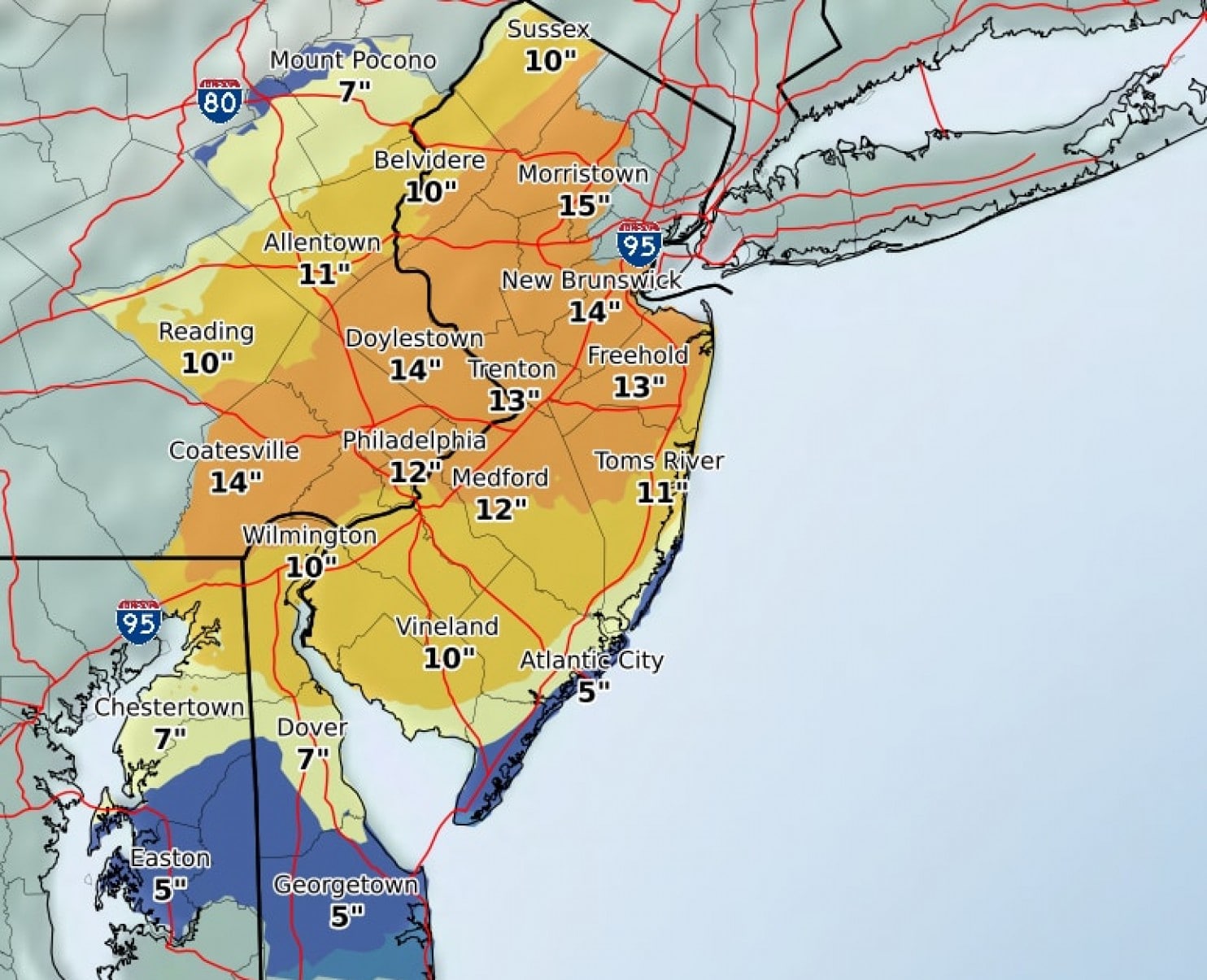
This image from the National Weather Service shows projected snowfall from the coming nor’easter during the next 24 hours.
This is a big storm with a long duration. It was expected to kick off in the Washington-Baltimore area this morning and will bluster its way northeast for the next two days until it dies down Thursday night in New England. This nor’easter is not a storm to be trifled with. According to The Washington Post, snowfall of over 2 inches an hour is possible, power outages due to wind and snow pileup are likely, and road traffic will be dangerous due to reduced visibility and blocked roads.
Per the Post: “In Philadelphia, wintry mix began Tuesday morning and is moving northward through eastern Pennsylvania and New Jersey. Ice accumulation is possible on roads and elevated surfaces, which will make travel dangerous. Tuesday night, precipitation will change to snow and will be heavy on Wednesday. Snow totals will range from 7 to 13 inches in the Philadelphia area.”
New York is expected to get off even worse, with 12 – 16 inches of snow forecasted. Long Island will be hot by blizzard conditions, and a winter mix of snow and sleet will pellet the Tri-State area. Connecticut, Rhode Island, and Massachusetts are facing the likelihood of similar conditions.


